Programme: “CULTURE 2000”
Title: Archaeological Landscapes In Europe
Acronym: Landscapes
Start - End: July 2004/July 2007
Location: Lecce – Marina di S. Cataldo
Lead Partner: English Heritage
Partners: Siena University, Foggia University , Euro-Mediterranean Cultural Heritage Agency. The project have also been joined by university authorities and organizations of the following countries: Germany, Belgium, Hungary, Hungary, Czech Republic, Estonia, Lithuania, Poland, Romania, Austria, Portugal, France, Slovakia, Slovenia.
Short Description:
The Aerial Archaeology Research Group (AARG), English Heritage (Historic Building and Monuments Commission for England) and various European partners joining the program, intended to promote the use of aerial survey and exploration methods related to the documentation, interpretation and preservation archaeological landscape of Europe.
The project aims to rebuild the location of ancient settlements and the old landscape of Salento, from ancient times to the present, with particular reference to the path that connected our city to its ancient port of St. Cataldo, leveraging aerial and terrestrial surveys, using GIS / GPS equipment and software.
This mapping, done with the innovative techniques described above, will enhance the cultural heritage and landscape of Salento, highlighting ancient settlements and ritual sites, landscapes and bringing to light of the past and the ancient routes of communication.
This will enable to map and understand the changes in our landscape over the millennia, highlighting evolution and the journeys of our culture
Targets:
The group of archaeological air research (AARG), the English Cultural Heritage Board (English Heritage) and all other partners who take part in this programme, intend to promote the use of aerial survey and explorative modes aiming to document, interpret and preserve the European archaeological landscape. The principal contribution of the University of the Salento to the European Landscapes project lies in the combination of new and traditional techniques to aid the understanding of the towns, settlements and landscapes of Southern Apulia (Salento) from antiquity to the present day. This is being achieved through specific procedures including aerial survey from light aircraft, employed for the first time in this part of Italy. Air photo analysis of the kind already taken to a high level of proficiency by the University of the Salento is complemented by traditional methods of ground-based archaeological survey. Satellite imagery is also being examined.
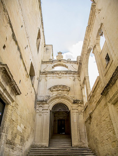
The city of Lecce, now capital of the homonymous province, was founded during the pre-Roman Iron Age by the local Messapian culture. It soon became one of the major central places of the Salento peninsula (the heel of Italy), despite the fact that it was land-locked, lying some 12 kilometres from the Adriatic to the east and 25 kilometres from the Ionian Sea to the west. Its principal overseas commerce depended on ports sited along the Adriatic coast, particularly that of San Cataldo. The project explores the archaeology of the relationship between Lecce and San Cataldo, particularly as the landscape between the two sites is rapidly changing because of aggressive agricultural development, the urban expansion of Lecce and tourist development along the coast.


